Friday, September 28, 2018

The War of 1812 and Kentucky's Role

https://www.ket.org/history/the-war-of-1812-and-kentuckys-role/

By Joyce West | 6/07/17 9:30 AM

Often called the United States’ “forgotten war,” the War of 1812 left an indelible mark on our nation’s history. Kentuckians played a vital role and paid dearly for it: 64 percent of Americans killed in the war were Kentuckians.

Kentucky Life followed the trail of Kentucky’s soldiers who fought in the war, from Michigan to New Orleans.

What prompted so many Kentuckians to join the fight?
Watch the Video https://ket.org/episode/KKYLI+002103
“The big thing here was…the history between the Indian nations and the British and the citizens of the commonwealth of Kentucky,” explained John Trowbridge, command historian of the Kentucky National Guard. Kentucky was the site of continuing warfare between settlers and the Native Americans, who were backed by the British.

Kentuckians were eager to fight, and Lexington’s Henry Clay was a leader of the War Hawks in Congress.
Six congressmen from Kentucky fought in the war. “People who voted for the war actually followed up their votes and fought in the war, and some of them died in the war,” said James C. Klotter, Ph.D., state historian of Kentucky.

Leading men into battle were William Henry Harrison, governor of Indiana territory, as well as Isaac Shelby, who was serving his second term as governor of Kentucky.
Another faction in the conflict was a confederation of numerous Native American tribes formed to block American expansion. Leading this alliance was the Shawnee leader Tecumseh. “Tecumseh is quite an incredible figure,” said John Bowes, Ph.D., associate professor history at Eastern Kentucky University. “Tecumseh is seen as the leader of this movement, this unique movement seeking to develop this pan-Indian confederacy that is bringing all these different tribes together.”
The First Nations confederacy had as its spiritual leader Tecumseh’s half-brother, known as the Prophet. “What is so often marginalized and put to the side is the very spiritual foundation for that confederacy,” Bowes said.

The Militia and the Long Rifle
When it came time to go to war, men of the commonwealth brought with them their Kentucky long rifles. Harold Edwards, historian and gunsmith at the William Whitley House in Crab Orchard, said the rifle was used every day by the settlers for hunting and protecting the family as well as for sport.
“It was their pastime, and they became very proficient with it. You know, the average range was probably a hundred yards,” Edwards said.

The British were still fighting in Napoleonic style, marching en masse with muskets, which had a range of 50-60 yards, Edwards said. “It was an old style of warfare dying fast, and unfortunately they learned it a little too late,” said Edwards.

What kind of soldiers were these Kentuckians? There is debate about that, Klotter said.
“Were they good soldiers or bad soldiers? They were a little of both,” said Klotter. “They were really good fighters, when they fought. But the militiamen of Kentucky were not trained. They wanted a quick fight, and then go home. They weren’t particularly good in following orders sometimes.”
This reputation led the British to compare the Native Americans with the undisciplined Kentucky fighters, said Trowbridge.

“The warfare in the West was viewed as a bit more savage,” said Bowes. “For the Americans it’s because of the presence of all these Indian allies. And for the British, it’s in part because of the Kentuckians.”

Remember the Raisin
On Aug. 12, 1812, more than a thousand Kentuckians headed north toward Michigan in summer clothing for what they expected to be a short war.

“After fighting their way up here…they arrived here in the winter of 1813, January, when Michigan was experiencing a very cold winter,” said Dan Downing, chief of interpretation at the River Raisin Battlefield National Park in Michigan.

Historians believe about 100 men died from starvation and exposure to the elements. Even so, the Americans won a victory at Frenchtown over the British. Then they set up for the next battle in haste.
“They don’t fortify the position,” said Klotter. “They know the British are on their way, but they put people in open fields, without any trenches or any kind of earthworks to protect them.”
The British and their Native American allies attacked at 6 in the morning on Jan. 22, 1813. One wing of the American forces was massacred, Klotter said. The other wing fought well but ran out of ammunition and was surrounded. The Americans surrendered, with 500 captured, 400 dead, and 100 who got away, Klotter said.

The captured, wounded men who could not travel stayed behind in cabins. “The great controversy is whether or not the British did all they could to protect those who were unable to travel back to Fort Malden in Canada,” said Downing.

The Native Americans, remembering the Kentuckians’ previous attacks on their villages, sought vengeance. “When an opportunity came to exact revenge, they took the opportunity,” said Downing.
The Native Americans went from cabin to cabin, killing 65 men, in what became known as the massacre of the River Raisin.

The Battle of the River Thames
More defeats that year lowered morale among the Americans, but the tide turned in the fall of 1813 when Americans won control of Lake Erie.

The British and their allies were retreating from Detroit into Canada. “From that moment forward, Tecumseh’s angry,” said Bowes. “Tecumseh cannot believe that the British are essentially surrendering that territory.”

On Oct. 5, 1813, the Kentuckians met the British and their allies again, this time in Ontario, at the Battle of the River Thames.

Twenty mounted Kentuckians, commanded by 64-year-old William Whitley of Kentucky, charged the Native American lines in what was called “Forlorn Hope.” The strategy was to draw fire, then send on the American infantry before the Native Americans could reload. “Only a couple of guys actually survived that charge,” said Trowbridge.

The British pulled back, and Tecumseh was killed. Whitley also was killed, and is buried on the battlefield in an unmarked grave.

The End of the War
After the victories in the West, the flashpoint of the war shifted eastward, to Washington, D.C. and Baltimore. The United States was pushed to the brink of bankruptcy because of the British naval blockade. Britain was war weary with its battles in North America and in Europe with Napoleon.
Negotiations to end the war began, and both sides tried to secure as much territory as possible.
All eyes turned to the port of New Orleans. The British sent a fleet of 8,000 men to take the city. Kentuckians were called to defend the port.

“The people of Kentucky were warmly welcomed here to New Orleans in anticipation of the battle,” said April Antonellis, the War of 1812 Bicentennial Coordinator for the National Park Service.
Andrew Jackson assembled a force of 5,000 to defend the city against the British. On Jan. 8, 1815, the Battle of New Orleans was waged on an old sugar plantation just outside the city limits.
The British, again relying on tactics used in the Napoleonic wars, were slaughtered by the Americans firing long rifles from behind earthworks. In a little more than 25 minutes, the British lost 2,600 men. The Americans lost 71.

“There were errors on the part of the British, leaving some supplies behind, most notably scaling ladders that they were supposed to use to come up over this rampart that the Americans had created,” Antonellis said.

The War of 1812 is often called the Second American Revolution.

“If the British had won this battle, New Orleans certainly would have become a British colony or a British territory,” she said. “I think it’s easy to say that much of the United States could have easily fallen to the British as well. Anywhere west of the Appalachian Mountains that had to trade on the Mississippi River, they would have to pass through the port of New Orleans. If that’s a British city, then it would be very difficult to maintain American control in that area.”

Who won the war? Strategists say it was a draw. In the end, Native Americans paid the ultimate price.
The treaty ending the War of 1812 was negotiated without their participation, and the Native American alliance lost territory it had hoped to hold. In the years after the war’s end, Indiana, Alabama, Illinois, and Mississippi became states.

“The floodgates opened in the aftermath of the war of 1812,” said Bowes.

Piqua Shawnee

"Piqua Shawnee"

Piqua Shawnee Tribe

Thursday, September 27, 2018

Shawnee Indian - Kansas

William G. Cutler's
History of the State of Kansas
was first published in 1883 by A. T. Andreas, Chicago, IL.

http://www.kancoll.org/books/cutler/deschist/indhistp5.html#EMIGRANT_TRIBES

The Missouri Shawnees were the first Indians removed to the territory set apart for emigrant tribes by the treaties of June, 1825, with the Kanzas and Osages. By treaty made at St. Louis, November 7, 1825, the United States granted "to the Shawnee tribe of Indians within the State of Missouri, for themselves, and for those of the same nation now residing in Ohio who may hereafter emigrate to the west of the Mississippi, a tract of land equal to fifty miles square, situated west of the State of Missouri, and within the purchase lately made from the Osages."

The tract of fifty miles square thus granted, as afterward surveyed and conveyed to the tribe by deed May 11, 1844, was bounded as follows: "Beginning at a point in the western boundary of the State of Missouri, three miles south of where said boundary crosses the mouth of Kansas River, thence continuing south and coinciding with said boundary for twenty-five miles; thence due west 120 miles; thence due north until said line shall intersect the southern boundary of the Kanzas Reservation; thence due east, coinciding with the southern boundary of said reservation, to the termination thereof; thence due north, coinciding with the eastern boundary of said reservation, to the southern shore of the Kansas River; thence along said southern shore of said river to where a line from the place of beginning, drawn due west, shall intersect the same."
1854-map
Map Kansas 1854
The Shawnees had their ancient home in the basin of the Cumberland River. Their territory was invaded by the Iroquois about the year 1672, and the vanquished Shawnees, fleeing to the South, were scattered over various parts of the country--settling in the Carolinas, at the head-waters of the Mobile River, in Florida, and it is related that one tribe had "quite gone down to New Spain." After a short time, several of the tribes re-united and returned to the vicinity of their old hunting-grounds, forming settlements in the valley of the Ohio, where Father Marquette relates that they were "in such numbers that they seem as many as twenty-three villages in one district, and fifteen in another, lying quite near each other."

Several treaties of peace had been made previous to 1786, with the Shawnees, in common with other tribes, but that of January 31, 1786, was the first concluded with them separately as a nation. By the provisions of this treaty, which was made at the mouth of the Great Miami River, on the northwest bank of the Ohio, the United States allotted to the Shawnees certain lands on the Miami River, contiguous to the reservations of the Wyandots and Delawares, in consideration of which the Shawnees, relinquished "all title, or pretense of title, they ever had to the lands east, west and south of the east, west and south lines before described."

The Wyandots protested against this treaty, on the ground that the lands set apart for the Shawnees had been previously, by treaty, ceded to themselves. The Shawnees remained, however, on the land, sharing the Wyandot hunting and fishing grounds, and it was in consideration of their forbearance at this time that the latter tribe requested the Shawnees to cede to them a portion of their reservation in the Indian Territory, when they attempted to negotiate for removal from Sandusky in 1832.
From the time of the treaty of peace which the Shawnees made with William Penn in 1682 (the first treaty with the whites to which they were a party), the Society of Friends took an intelligent and constant interest in their welfare. Thomas Chalkley, a minister of the London society of the denomination, who visited them as early as 1706, mentions among the peculiarities of the nation its custom of admitting women to its councils. He says: "In the council was a woman who took a part in the deliberations of this council, as well as upon all important occasions.

"On the interpreter being questioned why they permitted a woman to take so responsible a part in their councils, he replied that some women were wiser than some men, and that they had not done anything for years without the council of this ancient, grave woman, who spoke much in this council."

Philanthropic and religious enterprises were necessarily suspended during the long-continued French, English and Indian wars, but after the close of the war of 1812, the Friends again resumed their labors among the Shawnees, establishing a school, and building flour and saw mills at their village in Ohio. Under the prudent and energetic superintendence of Henry Harvey, the tribe made rapid advance in civilization, and in the year 1831, when their lands were bought by Government, preparatory to the removal of the tribe to the West, the Ohio Shawnees were prosperous in an eminent degree.
January 4, 1793, Baron De Carondelet, a Spanish nobleman, granted to bands of Shawanoes and Delawares who desired to settle there, a tract of land about twenty miles square, "lying between the River St. Come and Cape Geredeau, and bounded on the east by the Mississippi, and westwardly by White Water."

The Delawares removed from the tract in 1815; the Shawnees removed from their first location near the cape, and again removed as white settlers encroached on their lands, until, by the treaty of November 7, 1825, they relinquished all title to their Missouri lands, and removed to their reservation in what is now the State of Kansas. In 1831, a treaty was concluded with the Ohio Shawnees, giving them a certain sum for their improvements in that State, and land contiguous to the Missouri Shawnees in Indian Territory. A portion of the tribe removed in 1832; the remainder, in the fall of the following year.

The good results of the habits of thrift and industry which these Shawnees had acquired, aided and encouraged by the influence of the missionaries, who soon settled among them in their new location, were, after a few years, apparent in the comparatively comfortable houses and the well-cultivated fields which multiplied on their reservation.

An act was passed in 1853, granting the Ohio Shawanoes $66,000 additional compensation for their improvements in that State--twenty years after their removal. This sum was paid to the Ohio band at their reservation in Kansas.

On May 10, 1854, the tribe ceded to the United States the entire tract set apart for them November 7, 1825, and conveyed to the tribe by deed, May 11, 1844, containing about 1,600,000 acres, and by a provision of the same treaty, the United States retroceded to the tribe "200,000 acres to be selected between the Missouri State line and a line parallel thereto and west of the same thirty miles distant, which parallel line shall be drawn from the Kansas River to the southern boundary line of the country herein ceded."

Three sections of land were to be set apart to the Missionary Society of the Methodist Church South; 320 acres to the Friends' Shawnee Labor School; 160 acres to the American Baptist Missionary Union; five acres to the Shawnee Methodist Church; and two acres to the Shawnee Baptist Church--all to be considered a part of the retroceded 200,000 acres. The residue of the tract was to be divided, each individual receiving 200 acres, to be deeded in fee simple, and whatever remained to be set apart for any other Shawnees who might thereafter unite with the tribe.

The privilege of selecting lands extended to every head of a family who, though not a Shawnee, had legally married into the nation, according to their customs, all persons adopted into the tribe, all minor orphan children of Shawnees, and all incompetent persons, to have selections made adjacent to their friends and relatives.

Other provisions were as follows: "In the settlement known as Black Bob's Settlement, in which he has an improvement, whereon he resides, and in that known as Long Tail's Settlement, in which he has an improvement, whereon he resides, there are a number of Shawnees who desire to hold their lands in common; it is therefore agreed that all Shawnees, including the persons adopted as aforesaid, incompetent persons, and minor children who reside in said settlements, and all who shall, within sixty days after the approval of the surveys hereinafter provided for by the United States, signify their election to join either of said communities and reside with them, shall have a quantity of land assigned and set off to them in a compact body, at each of settlements aforesaid, equal to 200 acres to each individual in each of said communities."
"Piqua Shawnee"
Piqua Shawnee
Piqua Shawnee Tribe

Wednesday, September 26, 2018

Shawnee Indians - West Virginia

https://www.wvencyclopedia.org/articles/383

Williams, John Alexander "Shawnee." e-WV: The West Virginia Encyclopedia. 29 October 2010. Web. 26 September 2018.

The Shawnees were the southernmost of the Algonquian-speaking peoples of the eastern woodlands; hence their name, which derives from ‘‘southerner’’ in these languages. Originally centered in the mid-Ohio Valley, they descended, according to some archeologists, from the pre-historic Fort Ancient culture whose remains have been found in the Kanawha Valley, among other places. But they left this homeland during the 17th century, presumably in response to Iroquois attacks during the Beaver Wars, and were recorded by Europeans in such widely separated locations as Kentucky, Alabama, South Carolina, and Pennsylvania. A Shawnee companion of the French explorer, Robert Cavelier de la Salle, even traveled to Paris. The Shawnees entered frontier annals on a regular basis after Quaker missionaries found some of them living on Pequa Creek near present Lancaster, Pennsylvania, in 1692.

It is possible that the 17th century record represents the separate wanderings of the Shawnee’s principal divisions—Chalakaatha, Mequashake, Pekowi, Hathawikila, and Kishpoko—since the divisions traditionally lived in separate village clusters and were only loosely confederated. European transcriptions of these names in places such as Chillicothe and Piqua, Ohio, Sewickley, Pennsylvania, and Pickaway, West Virginia, testify to some of these wanderings. Thus it was the Pekowi who began the Shawnee return to the Ohio Valley when they moved from eastern to western Pennsylvania in 1728. By 1750, some 1,200 Shawnee were living in villages along the Ohio River, from which they launched attacks against the Virginia frontier during the French and Indian War and Pontiac’s Rebellion. Later they moved their villages to the Scioto River in southern Ohio, and after their defeat in Lord Dunmore’s War they moved again to the Miami River headwaters in southwest Ohio. They consistently claimed Virginia west of the Alleghenies to be their hunting lands, along with most of Kentucky. They also denied the right of the Iroquois to dispose of this territory, as the Iroquois did in land sales to colonial governments in 1744 and 1768.

Under the influence of a nativist religious revival first preached by the Delaware prophet Neolin, Shawnees took the lead in defending the Ohio country from the white advance across the Appalachians in Western Virginia and Kentucky and also sent emissaries to other tribes to preach the necessity of Indian unity. These efforts suffered a temporary setback with the Shawnee defeat in Dunmore’s War, but they continued during the American Revolution. During 1775–76, the Mequashake Shawnees led by Cornstalk adopted a neutralist position between the British and the rebel colonists, but members of other Shawnee bands formed war parties on their own or in concert with Mingos and militant Delawares. When Cornstalk was imprisoned and then murdered at Fort Randolph in 1777, the Mequashake joined the other bands in general warfare all along the frontier. White settlements along the Ohio, in the Kanawha Valley, and in Kentucky bore the brunt of these attacks, which continued through 1782, culminating in the famous second siege of Fort Henry at Wheeling in September of that year.

The Shawnees, along with other Indians resident in Ohio, were outraged when the British accepted Virginia’s claim to the territory between the Great Lakes and the Ohio and ceded this territory to the United States in the 1783 Treaty of Paris, following the Revolution. Disputing the validity of the British cession, Shawnee militants urged the other Ohio tribes and also the Cherokees to fight on. Assaults on the frontier and on white settlers traveling the Ohio River multiplied after 1786 and continued into the early 1790s. Though Euro-American beachheads were established in 1788 north of the Ohio at Marietta and Cincinnati, native resistance succeeded in defeating armies sent against their villages in 1790 and 1791. Only after a combined force of regular troops and militia commanded by Gen. Anthony Wayne defeated a Shawnee-led Indian force at the Battle of Fallen Timbers in northwest Ohio in 1794 did the militants agree to give up their Ohio lands.

The Treaty of Greenville in 1795 cleared the way for white settlement on both banks of the Ohio and ended the threat of raids in what is now West Virginia. Even then, however, the militant Shawnee spirit remained unconquered. In the early 19th century, a new revitalization movement spread under the leadership of the prophet Tenskwatawa and his warrior brother Tecumseh. This movement was centered in new Shawnee villages in what is now Indiana and did not directly affect West Virginia.


This Article was written by John Alexander Williams
Last Revised on October 29, 2010

Piqua Shawnee
Piqua Shawnee Tribe
"Piqua Shawnee"

Tuesday, September 25, 2018

Shawnee Indians - Texas

SHAWNEE INDIANS

TSHA - Texas State Historical Association
By Carol A. Lipscomb
 
SHAWNEE INDIANS. The Shawnees were one of many immigrant tribes from the United States who entered Texas in the late eighteenth and early nineteenth centuries. This eastern woodlands tribe originally inhabited the Ohio and Cumberland valleys in what is now Kentucky. Some Shawnee groups drifted farther south into the Piedmont area of Virginia, the Carolinas, and Georgia. The name Shawnee means "southerner" and identifies the tribe as one of the southernmost members of the Algonkian linguistic family.

The Shawnees moved about in search of game during winters. In the growing season they settled in rather large villages where they raised crops of corn, squash, and beans. The tribe carried on extensive trade in animal skins and salt; production of the latter was a major industry for the Shawnees, who extracted the mineral from the many salt springs in Kentucky. Because building material was abundant in the eastern woodlands, the tribe built permanent houses, called wigwams, and abandoned them when they moved. The wigwams were single-family dwellings made of poles and bark that could easily be constructed in a few days.

Shawnee clothing was made of dressed skins and consisted of a shirt for men and a longer overblouse for women. Both sexes wore leggings and moccasins. Their clothing was often decorated with dyed porcupine quills, bright-colored feathers, and paint.

The Shawnees came into contact with French missionaries, explorers, and fur traders in the mid-seventeenth century. During that same period, southern Shawnees began trading with the Spanish in Florida. By the early eighteenth century, the British were moving into Shawnee territory, and the tribe began a westward migration. During the American Revolution, the Shawnees fought fiercely to retain their hunting grounds, but after 1783 the rapid influx of whites into the trans-Appalachian region scattered them. By the early nineteenth century the tribe was spread from Ohio to Alabama.
Around 1790 a major Shawnee band migrated west of the Mississippi River to the area of Cape Girardeau, Missouri. By 1815 an estimated 1,200 Shawnees were settled there. They were joined by a large band of Delawares, and the two tribes became closely associated. In 1822 a band of the Missouri Shawnees, numbering about 270 families, migrated south into Texas, which was then a part of Mexico. They settled on the south bank of the Red River near Pecan Point. The Texas Shawnees petitioned the Mexican government for land, and in 1824 the governor of Coahuila and Texas, Rafael Gonzales, authorized the legislature to grant the tribe one square mile of land per family along the south bank of the Red River. The Shawnees became allies of the Cherokees and other immigrant tribes living in Texas, and all enjoyed a generally peaceful relationship with Mexican officials and a growing number of Anglo-American settlers. The Shawnees even aided the Mexicans in their war with the Comanches. In 1832 a party of Shawnees, led by chief John Linney, defeated a band of Penateka Comanches at Bandera Pass, west of San Antonio. When Texas became a republic, officials of the new government, under the leadership of President Sam Houston, worked to maintain good relations with the immigrant Indians, including the Shawnees. The tribe and their allies signed a treaty with Texas officials in February 1836. The agreement, however, which granted the Indians a designated tract of land, was never ratified by the Texas Senate. Houston's successor, Mirabeau B. Lamar, saw the immigrant Indians as unauthorized intruders and wanted them removed from Texas. In the summer of 1839, amid rumors of collusion between them and the Mexicans, he provoked the Cherokee War, which ultimately affected all of the immigrant Texas tribes. Lamar sent a message to Linney and the Shawnees asking them to remain neutral in the conflict, and most of the tribe complied with the request.

After the Cherokees were defeated, Shawnee leaders, including Chief Elanie, negotiated a treaty with Texas officials at Nacogdoches. According to its terms, the tribe promised to leave Texas peaceably if they received payment for improvements on their land, deserted crops, and all property left behind. The government agreed to provide transportation and supplies for the relocation. There is some evidence that Texas officials honored those treaty commitments, and by early 1840 most of the Texas Shawnees had moved north of the Red River into Indian Territory. The tribe settled on the Canadian River near the mouth of the Little River and became the nucleus of the present Absentee band of Shawnees. In 1846 they were joined by a large segment of Shawnees who had been forced to leave Kansas. The few scattered Shawnees who remained in Texas after the Cherokee War were consolidated in 1857 with remnants of other tribes on the Brazos Indian Reservation, near the site of present Graham. But the Texas reservation system was shortlived, and in 1859 the reserve Indians, including the Shawnees, were moved to Indian Territory. Those Shawnees joined the Absentee band on the Canadian River. Today many Shawnees still reside in eastern Oklahoma. The Loyal or Cherokee band is centered around White Oak in the northeastern corner of the state. The Absentee band is located in central Oklahoma between Tecumseh and Norman, and the Eastern band lives near Miami. Unlike most tribes now resident in Oklahoma, the Shawnees have managed to preserve to the present day their complete cycle of ceremonial dances and other religious observances.
 
Piqua Shawnee
"Piqua Shawnee"
Piqua Shawnee Tribe
 

Friday, September 21, 2018

History: National Congress of American Indians (NCAI)

Archived records at The Smithsonian National Museum of the American Indian

https://americanindian.si.edu/sites/1/files/archivecenter/AC010_ncai.pdf
Biographical Note
The National Congress of America Indians, which describes itself as the oldest and largest American Indian and Alaskan Native organization in the United States, was founded on November 16, 1944, in Denver, CO. NCAI was intended to serve as a link between individual tribal councils and the United States government, by defining and helping to crystallize Indian thought on the administration of Indian affairs. The Congress also aimed to educate the general public about Indians, preserve Indian cultural values, protect treaty rights with the United States, and promote Indian welfare.
At the first convention, delegates representing fifty tribes ratified the constitution and by-laws, drafted resolutions determining the direction of NCAI policy, and elected the organizations' first officers, with Oklahoma Supreme Court Justice Napoleon B. Johnson (Cherokee) as president. The officers, as well as eight elected council members, formed the Executive Council. The Council chose the Executive Director; Ruth Muskrat Bronson (Cherokee) was the organization's first director, from 1944-1948. "Persons of Indian blood" could join the organization either as individuals or as groups. In 1955, however, the constitution was revised to restrict group membership to recognized tribes, committees, or bands, and to make the Executive Council chosen by tribal  representatives. These changes gave control of the organization to governing bodies of organized tribes, rather than individuals. A further amendment that year created a five-member Executive Committee, headed by the president, which had all the powers of the Executive Council between council meetings.
Conventions have been held annually in the fall since the formation of the NCAI in 1944. Since 1977, mid-year conferences have been held in May or June of each year, to allow more frequent and thorough discussion of issues. The resolutions passed at these conventions are the basis for all policy of the Executive Committee and Executive Director between meetings. The conventions are also used for informational sessions and meetings of standing and special committees of NCAI. One or two-day workshops may also be held on special topics or Congressional issues of particular concern.
NCAI created a tax-exempt arm in 1949 to accept charitable contributions and apply for grants, the NCAI Fund, which soon changed its name to ARROW, Inc. By 1957, however, ARROW had split off to become an independent organization, and NCAI started a new arm, again called the NCAI Fund. In the coming decades, the NCAI Fund would obtain grants from sources including the Bureau of Indian Affairs, Department of Veteran Affairs, Indian Health Service, Nuclear Regulatory Commission, Ford Foundation,
humanities councils and others, which they used for conferences, workshops, publications, and other projects.
In its early years, NCAI fought for the recognition of land claims of Alaska natives, the enfranchisement of Arizona and New Mexico Indians, the equitable settlement of tribal land claims, and the right of Indians to select their own attorneys. The NCAI lobbied vigorously for an Indian Claims Commission Bill, which became law in August 1946. NCAI's lobbying efforts on behalf of this act set the pattern for the organization's future role in legislative matters: keeping member tribes abreast of proposed legislation andascertaining their views, and maintaining a presence in Congress through lobbying and testimony. Beginning in 1954, the threat of termination pushed NCAI into a period of increased activity. Although some tribes were ready to terminate their relationship with the federal government, much of Indian Country felt threatened by the government's new stated policy. NCAI therefore organized an Emergency Conference of American Indians for February 1954 to protest this new termination policy. An agreement was forged at the conference between the NCAI and the Bureau of Indian Affairs to work together toward slowly liquidating the BIA. The termination period of the 1950s and 1960s, while challenging, saw NCAI increase in confidence and political acumen.
During the 1960s, a number of other activist Indian groups sprang up and began to dilute the singular influence which NCAI had commanded. Newer, more militant groups often considered themselves at odds with NCAI, which was increasingly perceived as conservative. As the number of Indian advocacy groups grew in the 1960s and 1970s, however, NCAI actively partnered with other organizations, particularly the National Tribal Chairmen's Association (NTCA) and Native American Rights Fund (NARF), on a variety of projects.
Piqua Sawnee Tribe
"Piqua Shawnee"

Thursday, September 20, 2018

75th Annual NCAI Convention & Marketplace

NCAI Conference 2018
Date: Oct 21, 2018 - Oct 26, 2018
Where: Denver, CO

View Agenda >>

About the Event:
We are excited to celebrate our 75th Anniversary in Denver, Colorado where our first convening was held in 1944! We hope you can join us. We look forward to welcoming you!

Registration Now Open! Register now online, or click here to download and print the registration form and submit with payment.

75th Anniversary Book "Honoring The Past"
Fill out our NCAI Alumni Contact Form to help us connect with you!
Call for photos, stories, and quotes for the 75th Anniversary!

We have a number of exciting activities planned including our 75th Anniversary book Honoring the Past!  Submit your photos, stories, and quotes to NCAI to be included in our materials for the year. Get started by filling out the form here.
Questions? Email ncai@ncai.org for more information.

Marketplace
The Marketplace offers a wonderful opportunity to shop with top Indian Arts & Crafts vendors, talk with representatives from Federal programs and Tribal Enterprises, and receive career, education, and health information from the wide variety of vendors. The Marketplace is open to the general public.

http://www.ncai.org/events/2018/10/21/75th-annual-convention-marketplace
http://www.ncai.org/

Piqua Shawnee
"Piqua Shawnee"
Piqua Shawnee Tribe

Wednesday, September 19, 2018

Alabama Indian Affairs Commission

Rachel Naftel, Auburn University
 
The Alabama Indian Affairs Commission (AIAC), headquartered in Montgomery, Montgomery County, was established by the Alabama State Legislature in 1984 to serve as a liaison between Native Americans in the state and local, state, and federal agencies. Primarily, the AIAC aims to connect the Native American community in the state with local, state, and federal resources, including funding, for their social and economic development programs. In addition, it is tasked with developing criteria for recognition for Indian tribes, bands, or groups, and advocating for and promoting Indian rights.
The state government recognizes nine Native American tribes in Alabama: the Poarch Band of Creek Indians, the Echota Cherokee Tribe of Alabama, the Cherokee Tribe of Northeast Alabama, the Ma-Chis Lower Creek Indian Tribe of Alabama, the Star Clan of Muscogee Creeks, the Cher-O-Creek Intra Tribal Indians, the MOWA Band of Choctaw Indians, the Piqua Shawnee Tribe, and the United Cherokee Ani-Yun-Wiya Nation. Of this group, only the Poarch Band of Creeks is officially recognized by the federal government.
 
Governance
The AIAC is comprised of 13 members consisting of one representative from each of the nine Indian tribes served by the AIAC as well as a member of the Alabama Senate appointed by the lieutenant governor, a member of the Alabama House of Representatives appointed by the speaker, an at-large member appointed by the governor, and a member appointed by the commission who is a member of a federally recognized tribe not a member of any tribe represented on the commission. Commissioners serve four-year terms and are eligible for reappointment. The commission selects officers every two years and these include a chair, vice chair, parliamentarian, and executive director. The chair presides over all meetings and exercises general supervision of the commission. Meetings take place at the headquarters in Montgomery and are open to the public and posted on the AIAC website. AIAC operations are funded by the state government. The executive director, chair, and vice chair have fiscal responsibility for the funds. Members of the commission receive no compensation for their services, other than reimbursements for travel and expenses incurred while performing their duties as commissioner.
 
Functions
The commission's primary purpose is to promote local, state, and federal government resources for Indian citizens in the state and actively seek government grants or funds available to eligible Native Americans. It has the authority to recognize Indian tribes as well as the authority to prescribe the rules for the recognition of Indian tribes, bands, groups, and associations, which is a complicated process. Its work also involves administrative and financial activities, particularly managing the agency and its finances, human resources, and facilities and providing information about legislation that affects Indians in Alabama.
 
One of the AIAC's continuing accomplishments is its scholarship program. The AIAC offers annual scholarships to Native American residents of Alabama pursuing a college degree within the state. To qualify, students must be enrolled in the federal/state recognized tribe for a minimum of three years and meet his or her tribe's internal qualifications. These scholarships give special considerations to students pursuing nursing, medical, veterinary, and pharmacy degrees. In addition to the scholarships, the AIAC sponsors the Ms. Indian Alabama Pageant, with the winner receiving a $5,000 scholarship.
 
Since its inception, the AIAC has sponsored economic development workshops and created the Alabama Indian Small Business Association; the commission maintains a list of Indian-operated businesses in the state. The Alabama Indian Community Loan Fund was created to help find organizations to invest in Indian businesses. (The casinos and hotels of the Poarch Band are perhaps the most visible projects undertaken in the state.) In addition, the commission has worked with historical organizations, including the Alabama Department of Archives and History for an ethnic studies program. The AIAC has raised warnings about the destruction of historic sites and collaborated with the Alabama Historical Commission on a statewide historic preservation plan.
 
Piqua Shawnee Tribe
"Piqua Shawnee"

Tuesday, September 18, 2018

Shawnee: Arkansas

Shawnee

Among the immigrant Native Americans who lived in territorial Arkansas were several Shawnee communities. They came from Indiana and Missouri at the invitation of the Cherokee after the Treaty of 1817 created the Cherokee Nation on land in the Ozarks between the White and Arkansas rivers. The Shawnee, who built settlements on Crooked Creek and White River, departed after more than a decade of life in Arkansas.

The Shawnee were a large Algonkian-speaking tribe, widely scattered across the eastern woodlands. By the middle of the eighteenth century, the majority of them were living in the area both north and south of the Ohio River. Euro-American settlers from the east brought on years of violence. In a peace treaty in 1774, the Shawnee were forced to cede Kentucky, and the continuing hostilities led some Shawnee in 1779 to move west across the Mississippi River to a large grant south of Ste. Genevieve that had been given by the Spanish government. From that new location, they became familiar with the Ozarks and the western prairies.

After the death of Tecumseh and the collapse of his fight against the United States in 1813, one faction of the Shawnee sought ways to coexist with the Americans, and some saw the migration of the whole tribe to the west as a good strategy. When the Western Cherokee, living in the Ozarks after 1817, became embroiled in skirmishes with the Osage, they invited eastern tribes, including the Shawnee, to move to their land west of the White River. One group, led by Quatawapea, also known as Captain or Colonel Lewis, settled on the White River, with their major town at Shawneetown, a location that later became Yellville (Marion County).

As guests of the Cherokee, the Shawnee were part of a larger group of immigrants into the White River Valley, a group that included the Delaware, Piankashaw, Miami, and other Indian groups. If they ever participated with the Cherokee in military campaigns against the Osage, the documents do not record it. No recorded instances exist of hostilities between the Shawnee and the American settlers, although the latter petitioned Washington for a military garrison for protection. In later years, several of the early settlers wrote their memoirs of that time, and they included several accounts of unpleasant encounters between the two groups, as well as visits to the Shawnee Green Corn ceremonies, hunting together, and a Shawnee-American marriage.

In 1828, the Western Cherokee entered a new treaty arrangement with the United States in which their Ozark holdings were traded for land in Indian Territory, present-day Oklahoma. They soon moved west and established Tahlequah, where the Cherokee tribal government remains today. Their Indian guests, left as squatters on government land, also moved away from Arkansas during the next few years. By 1833, the Shawnee had gone to Texas and Indian Territory, and the Ozark land was again open to American settlers. Modern Shawnee have few records of the Arkansas period in their complex history.

For additional information:Edmunds, R. David. The Shawnee Prophet. Lincoln: University of Nebraska Press, 1983.

Foreman, Grant. Indians and Pioneers: The Story of the American Southwest before 1830. Norman: University of Oklahoma Press, 1930.

Ingenthron, Elmo. Indians of the Ozark Plateau. Point Lookout, MO: School of the Ozarks Press, 1970.

Jeffery, A. C. Historical and Biographical Sketches of the Early Settlement of the Valley of White River Together with a History of Izard County. Edited by Dale Hanks. Richmond, VA: The Jeffery Historical Society, 1973.

Johnston, James J. “Searcy County Indians in Tradition and History.” Mid-America Folklore 12 (Spring 1984): 24–31.

Lankford, George E. “Shawnee Convergence: Immigrant Indians in the Ozarks.” Arkansas Historical Quarterly 58 (Winter 1999): 390–413.

Sugden, John. Tecumseh: A Life. New York: Henry Holt and Co., 1997.

Turnbo, Silas C. Turnbo’s Tales of the Ozarks: Schools, Indians, Hard Times and More Stories. Edited by Desmond Walls Allen. Conway, AR: Arkansas Research, 1987.

George E. Lankford
Batesville, Arkansas
Last Updated 6/21/2010
"Piqua Shawnee"
Piqua Shawnee
Piqua Shawnee Tribe

Monday, September 17, 2018

History Of The Shawnee: Part 3

PART 3:
As published in the Official Newsletter of the Piqua Shawnee (Fall 2018)
By Barbara Lehmann, Piqua Shawnee Tribal Historic Preservation Officer
 
Barbara’s History Corner:
 
Bezallion informed the governor that the Shaonois of Carolina he was told had killed several Christians; whereupon the government of that province raised the said flat headed Indians, and joined some Christians to them, besieged and have taken, as it is thought, the said Shaonois town.” Those who escaped probably fled to the north and joined their kindred in Pennsylvania. In 1708 Gov. Johnson, of South Carolina, reported the “Savannahs” on Savannah River as occupying 3 villages and numbering about 150 men 6. In 1715 the “Savanos” still in Carolina were reported to live 150 miles northwest of Charleston, and still to occupy 3 villages, but with only 233 inhabitants in all.

A part of those who had come from the south in 1694 had joined the Mahican and become a part of that tribe. Those who had settled on the Delaware, after remaining there some years, removed to the Wyoming valley on the Susquehanna and established themselves in a village on the west bank near the present Wyoming, Pennsylvania. It is probable that they were joined here by that part of the tribe which had settled at Pequea, which was abandoned about 1730. When the Delawares and Munsee were forced to leave the Delaware River in 1742 they also moved over to the Wyoming valley, then in possession of the Shawnee, and built a village on the east bank of the river opposite that occupied by the latter tribe. In 1740 the Quakers began work among the Shawnee at Wyoming and were followed two years later by the Moravian Zinzendorf. As a result of this missionary labor the Shawnee on the Susquehanna remained neutral for some time during the French and Indian war, which began in 1754, while their brethren on the Ohio were active allies of the French. About the year 1755 or 1756, in consequence of a quarrel with the Delawares, said to have been caused by a childish dispute over a grasshopper, the Shawnee abandoned the Susquehanna and joined the rest of their tribe on the upper waters of the Ohio, where they soon became allies of the French. Some of the eastern Shawnee had already joined those on the Ohio, probably in small parties and at different times, for in the report of the Albany congress of 1754 it is found that some of that tribe had removed from Pennsylvania to the Ohio about 30 years previously, and in 1735 a Shawnee band known as Shaweygria (Hathawekela), consisting of about 40 families, described as living with the other Shawnee on Allegheny river, refused to return to the Susquehanna at the solicitation of the Delawares and Iroquois. The only clue in regard to the number of these eastern Shawnee is Drake’s statement that in 1732 there were 700 Indian warriors in Pennsylvania, of whom half were Shawnee from the south. This would give them a total population of about 1,200, which is probably too high, unless those on the Ohio are included in the estimate.

Having shown the identity of the Savannah with the Shawnee, and followed their wanderings from Savannah river to the Ohio during a period of about 80 years, it remains to trace the history of the other, and apparently more numerous, division upon the Cumberland, who preceded the Carolina band in the region of the upper Ohio river, and seem never to have crossed the Alleghanies to the eastward.
Moll-Map-of-1720-small
Moll’s map of 1720 has “Savannah Old Settlement” at the mouth of the Cumberland, showing that the term Savannah was sometimes applied to the Western as well as to the eastern band
These western Shawnee may possibly be the people mentioned in the Jesuit Relation of 1648, under the name of “Ouchaouanag,” in connection with the Mascoutens, who lived in northern Illinois. In the Relation of 1670 we find the “Chaouanon” mentioned as having visited the Illinois the preceding year, and they are described as living some distance to the south east of the latter. From this period until their removal to the north they are frequently mentioned by the French writers, sometimes under some form of the collective Iroquois name Toagenha, but generally under their Algonquian name Chaouanon. La Harpe, about 1715, called them Tongarois, another form of Toagenha. All these writers concur in the statement that they lived upon a large southern branch of the Ohio, at no great distance east of the Mississippi. This was the Cumberland River of Tennessee and Kentucky, which is called the River of the Shawnee on all the old maps down to about the year 1770.

 
When the French traders first came into the region the Shawnee had their principal village on that river near the present Nashville, Tennessee. They seem also to have ranged northeastward to Kentucky River and southward to the Tennessee. It will thus be seen that they were not isolated from the great body of the Algonquian tribes, as has frequently been represented to have been the case, but simply occupied an interior position, adjoining the kindred Illinois and Miami, with whom they kept up constant communication. As previously mentioned, the early maps plainly distinguish these Shawnee on the Cumberland from the other division of the tribe on Savannah River.

These western Shawnee are mentioned about the year 1672 as being harassed by the Iroquois, and also as allies and neighbors of the Andaste, or Conestoga, who were themselves at war with the Iroquois. As the Andaste were then incorrectly supposed to live on the upper waters of the Ohio River, the Shawnee would naturally be considered their neighbors. The two tribes were probably in alliance against the Iroquois, as we find that when the first body of Shawnee removed from South Carolina to Pennsylvania, about 1678, they settled adjoining the Conestoga, and when another part of the same tribe desired to remove to the Delaware in 1694 permission was granted on condition that they make peace with the Iroquois. Again, in 1684, the Iroquois justified their attacks on the Miami by asserting that the latter had invited the Satanas (Shawnee) into their country to make war upon the Iroquois. This is the first historic mention of the Shawnee evidently the western division in the country north of the Ohio River. As the Cumberland region was out of the usual course of exploration and settlement, but few notices of the western Shawnee are found until 1714, when the French trader Charleville established himself among them near the present Nashville. They were then gradually leaving the country in small bodies in consequence of a war with the Cherokee, their former allies, who were assisted by the Chickasaw. From the statement of Iberville in 1702 8 it seems that this was due to the latter’s efforts to bring them more closely under French influence. It is impossible now to learn the cause of the war between the Shawnee and the Cherokee. It probably did not begin until after 1707, the year of the final expulsion of the Shawnee from South Carolina by the Catawba, as there is no evidence to show that the Cherokee took part in that struggle.

From Shawnee tradition the quarrel with the Chickasaw would seem to be of older date. After the reunion of the Shawnee in the north they secured the alliance of the Delawares, and the two tribes turned against the Cherokee until the latter were compelled to ask peace, when the old friendship was renewed. Soon after the coming of Charleville, in 1714, the Shawnee finally abandoned the Cumberland valley, being pursued to the last moment by the Chickasaw. In a council held at Philadelphia in 1715 with the Shawnee and Delawares, the former, “who live at a great distance,” asked the friendship of the Pennsylvania government. These are evidently the same who about this time were driven from their home on Cumberland river.

To Be Continued Winter 2018
 
Piqua Shawnee Tribe
"Piqua Shawnee"


Friday, September 14, 2018

History Of The Shawnee: Part 2

PART 2:

As published in the Official Newsletter of the Piqua Shawnee (Fall 2018)

By Barbara Lehmann, Piqua Shawnee Tribal Historic Preservation Officer


Barbara’s History Corner:
On De l’Isle’s map, also, we find the Savannah River called “R.des Chouanons,” with the “Chaouanons” located upon bothbanks in its middle course. As to Gallatin’s statement that the name of the Savannahs is dropped after Lawson’s mention in 1701, we learn from numerous references, from old records, in Logan’s Upper South Carolina, published after Gallatin’s time, that all through the period of the French and Indian war, 50 years after Lawson wrote, the “Savannahs” were constantly making inroads on the Carolina frontier, even to the vicinity of Charleston. They are described as “northern savages” and friends of the Cherokee, and are undoubtedly the Shawnee. In
1749 Adair, while crossing the middle of Georgia, fell in with a strong party of “the French Shawano,” who were on their way, under Cherokee guidance, to attack the English traders near Augusta. After committing some depredations they escaped to the Cherokee. In another place he speaks of a party of “Shawano Indians,” who, at the instigation of the French, had attacked a frontier settlement of Carolina, but had been taken and imprisoned. Through a reference by Logan it is found that these prisoners are called Savannahs in the records of that period. In 1791 Swan mentions the “Savannas” town among the Creeks, occupied by “Shawanese refugees.” Having shown that the Savannah and the Shawnee are the same tribe, it remains to be seen why and when they removed from South Carolina to the north. The removal was probably owing to dissatisfaction with the English setters, who seem to have favored the Catawba at the expense of the Shawnee. Adair, speaking of the latter tribe, says they had formerly lived on the Savannah River, “till by our foolish measures they were forced to withdraw northward in defense of their, freedom.” In another place he says, “by our own misconduct we twice lost the Shawano Indians, who have since proved very hurtful to our colonies in general.” The first loss referred to is probably the withdrawal of
the Shawnee to the north, and the second is evidently their alliance with the French in consequence of the encroachments of the English in Pennsylvania.
Their removal from South Carolina was gradual, beginning about 1677 and continuing at intervals through a period of more than 30 years. The ancient Shawnee villages formerly on the sites of Winchester, Virginia, and Oldtown, near Cumberland, Maryland, were built and occupied probably during this migration. It was due mainly to their losses at the hands of the Catawba, the allies of the English, that they were forced to abandon their country on the Savannah; but after the reunion of the tribe in the north they pursued their old enemies with unrelenting vengeance until the Catawba were almost exterminated. The hatred cherished by the Shawnee toward the English is shown
by their boast in the Revolution that they had killed more of that nation than had any other tribe.
The first Shawnee seem to have removed from South Carolina in 1677 or 1678, when, according to Drake, about 70 families established themselves on the Susquehanna adjoining the Conestoga in Lancaster County, Pennsylvania, at the mouth of Pequea creek. Their village was called Pequea, a form of Piqua. The Assiwikales (Hathawekela) were a part of the later migration. This, together with the absence of the Shawnee names Chillicothe and Mequachake east of the Alleghanies, would seem to show that the Carolina portion of the tribe belonged to the first named divisions. The chief of Pequea was Wapatha, or Opessah, who made a treaty with Penn at Philadelphia in 1701, and more than 50 years afterward the Shawnee, then in Ohio, still preserved a copy of this treaty. There is no proof that they had a part in Penn’s first treaty in 1682.
In 1694, by invitation of the Delawares and their allies, another large party came from the south probably from Carolina and settled with the Munsee on the Delaware, the main body fixing themselves at the mouth of Lehigh river, near the present Easton, Pennsylvania, while some went as far down as the Schuylkill. This party is said to have numbered about 700, and they were several months on the journey. Permission to settle on the Delaware was granted by the Colonial government on condition of their making peace with the Iroquois, who then received them as “brothers,” while the Delawares acknowledged them as their “second sons,” i. e. grandsons. The Shawnee today refer to the Delawares as their grandfathers. From this it is evident that the Shawnee were never conquered by the Iroquois, and, in fact, we find the western band a few years previously assisting the Miami against the latter. As the Iroquois, however, had conquered the lands of the Conestoga and Delawares, on which the Shawnee settled, the former still claimed the prior right of domain. Another large part of the Shawnee probably left South Carolina about 1707, as appears from a statement made by Evans in that year 5, which shows that they were then hard pressed in the south. He says: “During our abode at Pequehan [Pequea] several of the Shaonois Indians from ye southward came to settle here, and were admitted so to do by Opessah, with the governor’s consent, at the same time an Indian, from a Shaonois town near Carolina came in and gave an account that four hundred and fifty of the flat headed Indians [Catawba] had besieged them, and that in all probability the same was taken.
To Be Continued
Piqua Shawnee Tribe
"Piqua Shawnee"

Thursday, September 13, 2018

History Of The Shawnee: Part 1

PART 1
As published in the Official Newsletter of the Piqua Shawnee (Summer 2018)
By Barbara Lehmann, Piqua Shawnee Tribal Historic Preservation Officer

Barbara’s History Corner:
The history of the Shawnee begins in 1669-70. They were then living in two bodies at a
considerable distance apart, and these two divisions were not fully united until nearly a century later, when the tribe settled in Ohio. The attempt to reconcile conflicting statements without a knowledge of this fact has occasioned much of the confusion in regard to the Shawnee. The apparent anomaly of a tribe living in two divisions at such a distance from each other is explained when we remember that the intervening territory was occupied by the Cherokee, who were at that time the friends of the Shawnee. The evidence afforded by the mounds shows that the two tribes lived together for a considerable period, both in South Carolina and in Tennessee, and it is a matter of history that the Cherokee claimed the country vacated by the Shawnee in both states after the removal of the latter to the north. It is quite possible that the Cherokee invited the Shawnee to settle upon their eastern frontier in order to serve as a barrier against the attacks of the Catawba and other enemies in that direction. No such necessity existed for protection on their northwestern frontier.
The earliest notices of the Carolina Shawnee represent them as a warlike tribe, the enemies of the Catawba and others, who were also the enemies of the Cherokee. In Ramsey’s Annals of Tennessee is the statement, made by a Cherokee chief in 1772, that 100 years previously the Shawnee, by permission of the Cherokee, removed from Savannah River to the Cumberland, but were afterward driven out by the Cherokee, aided by the Chickasaw, in consequence of a quarrel with the former tribe. While this tradition does not agree with the chronological order of Shawnee occupancy in the two regions, as borne out by historical evidence, it furnishes additional proof that the Shawnee occupied territory upon both rivers, and that this occupancy was by permission of the Cherokee.
De-lIsle-Map-Detail-1700
De l’Isle’s map of 1700

De l’Isle’s map of 1700 places the “Ontouagannha.” which here means the Shawnee, on the headwaters of the Santee and Pedee rivers in South Carolina, while the “Chiouonons” are located on the lower Tennessee River. Senex’s map of 1710 locates a part of the “Chaouenons” on the headwaters of a stream in South Carolina, but seems to place the main body on the Tennessee. Moll’s map of 1720 has “Savannah Old Settlement” at the mouth of the Cumberland, showing that the term Savannah was sometimes applied to the Western as well as to the eastern band.
The Shawnee of South Carolina, who included the Piqua and Hathawekela divisions of the tribe, were known to the early settlers of that state as Savannahs, that being nearly the form of the name in use among the neighboring Muskhogean tribes. A good deal of confusion has arisen from the fact that the Yuchi and Yamasee, in the same neighborhood, were sometimes also spoken of as Savannah Indians. Bartram and Gallatin particularly are confused upon this point, although, as is hardly necessary to state, the tribes are entirely distinct. Their principal village, known as Savannah Town, was on Savannah River, nearly opposite the present Augusta, Ga. According to a writer of 1740 it was at New Windsor, on the north bank of Savannah River, 7 miles below Augusta. It was an important trading point, and Ft Moore was afterward built upon the site. The Savannah river takes its name from this tribe, as appears from the statement of Adair, who mentions the “Savannah river, so termed on account of the Shawano Indians having formerly lived there,” plainly showing that the two names are synonyms for the same tribe. Gallatin says that the name of the river is of Spanish origin, by which he probably means that it refers to “savanas,” or prairies, but as almost all the large rivers of the Atlantic slope bore the Indian names of the tribes upon their banks, it is not likely that this river is an exception, or that a Spanish name would have been retained in an English colony. In 1670, when South Carolina was first settled, the Savannah were one of the principal tribes southward from Ashley River. About 10 years later they drove back the Westo, identified by Swanton as the Yuchi, who had just previously nearly destroyed the infant settlements in a short but bloody war. The Savannah seem to have remained at peace with the whites, and in 1695, according to Gov. Archdale, were “good friends and useful neighbors of the English.” By a comparison of Gallatin’s paragraph with Lawson’s statements from which he quotes, it will be seen that he has misinterpreted the earlier author, as well as misquoted the tribal forms.
Lawson traveled through Carolina in 1701, and in 1709 published his account, which has passed through several reprints, the last being in 1860. He mentions the “Savannas” twice, and it is to be noted that in each place he calls them by the same name, which, however, is not the same as any one of the three forms used by Gallatin in referring to the same passages. Lawson first mentions them in connection with the Congaree as the “Savannas, a famous, warlike, friendly nation of Indians, living to the south end of Ashley River.” In another place he speaks of “the Savanna Indians, who formerly lived on the banks of the Messiasippi, and removed thence to the head of one of the rivers of South Carolina, since which, for some dislike, most of them are removed to live in the quarters of the Iroquois or Sinnagars [Seneca], which are on the heads of the rivers that disgorge themselves into the bay of Chesapeak.” This is a definite statement, plainly referring to one and the same tribe, and agrees with what is known of the Shawnee.
(to be continued)
Piqua Shawnee Tribe

Wednesday, September 12, 2018

Smithsonian: Museum of The American Indian

Nation to Nation: Treaties Between the United States and American Indian Nations

Exhibit: September 21, 2014–2021
Washington, DC

Muscogee (Creek) bandolier bag, ca. 1814. Alabama. Wool fabric and tassels, silk fabric, dye, glass beads, cotton thread. Photo by Ernest Amoroso, NMAI. (24/4150)

From a young age, most Americans learn about the Founding Fathers, but are told very little about equally important and influential Native diplomats and leaders of Indian Nations. Treaties lie at the heart of the relationship between Indian Nations and the United States, and Nation to Nation: Treaties Between the United States and American Indian Nations is the story of that relationship, including the history and legacy of U.S.–American Indian diplomacy from the colonial period through the present.
Generous support for the exhibition is provided by:
Shakopee Mdewakanton Sioux Community - Bank of America - San Manuel Band of Mission Indians - Interface Media Group
http://www.nmai.si.edu/explore/exhibitions/item/?id=934
Piqua Shawnee
Piqua Shawnee Tribe

Tuesday, September 11, 2018

Bluejacket Carved Walking Stick


Walking stick

Walking Stick

Shawnee tribal leader Charles Bluejacket carved this walking stick for his friend Charles Boles, a Methodist missionary, in the mid- to late-19th century. The two met in Kansas in the early 1850s, when the church assigned Boles to preach to the Shawnee tribe.

A deep friendship took root between two men in the wilds of Kansas. Their bond spanned the differences of culture and race, and lasted a lifetime. Today we often think of encounters between whites and American Indians on the frontier as tense, even violent. This was not always the case. The likelihood that individuals would get along depended on their personalities and as well as the circumstances under which they interacted. In this regard, Bluejacket and Boles may have been predisposed to friendship. Both men were deeply religious. They fathered large families, and lived respectable lives by European-American standards.

Charles Bluejacket came to Kansas as a youth after a treaty with the United States government removed the Shawnees from Ohio and Missouri. His grandfather was the famous chief Bluejacket, and his grandmother probably was white. Charles was familiar with Indian missions, having attended a Quaker school in Ohio. In Kansas, he completed his education at another mission school. He married, became a successful farmer and interpreter for the federal government, and began leading a prayer group.

Charles Boles converted to Methodism as a young man in Missouri and was ordained an elder in 1851. The following year he was assigned to the Shawnee Indian Mission School in present-day Kansas City. It was during his six-year ministry to the tribe that he became friendly with Bluejacket.

Shawnee Methodist Mission

Conditions were primitive at many frontier missions, but not at Shawnee Indian Mission. The Methodist church considered it an exemplary site, as did the federal government (a major funding source). At its height, the mission occupied almost 2,000 acres, much of it farmland. Its grounds had brick schoolhouses and dormitories, workshops, and farm buildings. Because the Methodists used "circuit riders" (traveling ministers) to spread the gospel, Shawnee Mission was Boles' headquarters, although he spent most days in the field ministering to his flock.

Charles BluejacketCharles BolesDetails on the friendship between Boles and Bluejacket are spotty, but the two men obviously saw each other frequently and perhaps even rode the circuit together. One early visitor to the area noted that he met Bluejacket and Boles at another missionary's home in 1857. The Methodist conference minutes for this time period record that Boles was "assisted" by Bluejacket and others in building the church rolls to about 100 Shawnees.

The six years Boles preached to the Shawnee tribe coincided with the Bleeding Kansas era, when violence exploded along the Kansas-Missouri border. It became extremely difficult to accomplish any missionary work. The Methodist conference minutes for this period note, "There was comparatively little done from 1855 to 1865. During these perilous years Bro. Boles stood almost alone." Almost alone, but not quite. His friend Bluejacket had become an ordained minister in 1859. When war made it impossible for whites to preach at Shawnee Mission, Bluejacket became missionary in charge.

A number of mission schools closed during the Civil War, including Shawnee Mission. Methodists continued to preach to the tribes remaining in Kansas, but most American Indians were removed to Indian Territory (present-day Oklahoma) shortly after the war. Boles began preaching to non-Indian Methodists in eastern Kansas. Bluejacket became a prosperous farmer, despite the fact that many of his fellow tribesmen had moved south. An 1874 county atlas describes his "beautiful farm" and house "furnished in a style that would do credit to many of our wealthy people."

Bluejacket eventually joined his tribesmen in Indian Territory, but before he left he made this elaborate walking stick for Boles. Its carved figures include at least two motifs from the pillars of an early Shawnee council-house in Kansas--a rattlesnake and a turtle, the latter being prominent in Shawnee creation mythology. View a close-up of the turtle carving. The walking stick was passed down in the Boles family until the Kansas State Historical Society acquired it in 2009. It is in the collections of the Society's Kansas Museum of History.

https://www.kshs.org/kansapedia/walking-stick/10388

Entry: Walking Stick
Author: Kansas Historical Society
Author information: The Kansas Historical Society is a state agency charged with actively safeguarding and sharing the state's history.
Date Created: July 2009
Date Modified: December 2014

Piqua Shawnee
Piqua Shawnee Tribe

Monday, September 10, 2018

Traveling Through Time - Shawnee Indians

Shawnee Indians
A monument commemorates their departure in Hardin

The Shawnee Indians, also of Algonquian stock, lived in the east and Midwest. Their first contact with white men came in the 1600s. Early estimates of their population range from 3,000 to 50,000, although 10,000 appears to be the most probable estimate. Shawnee comes from the Algonquian word ‘Shawun’ (shawunogi) meaning ‘southerner.’ The application of southerner is indicative of their location vis-a-vis the other Algonquian tribes who lived to the Shawnee’s north, around the Great Lakes. A symbol of the Shawnee authority is the eagle feather headdress.

During the 1600s, they were forced to leave their traditional lands, including the Ohio Valley, by the marauding Iroquois during the Beaver Wars. In the 1700s, they once again began to call the Ohio Valley their home, settling initially along the Ohio River where conflict with white settlers became a routine occurrence. Allying themselves with the British during the Revolutionary War, combined with being absolutely against white expansion beyond the Appalachian Mountains, did not endear them to the Americans. Led into battle by Chief Cornstalk, they were severely defeated by colonial troops in 1774 in the area of Point Pleasant, West Virginia.

The loss resulted in a split in the Shawnee tribe that caused many of them to move west beyond the Mississippi River. Those that stayed behind in Ohio rallied behind Tecumseh until the 1811 Tippecanoe defeat and the death of Tecumseh in Canada during the War of 1812.
The Shawnee village of Piqua (Piquea), located four miles southwest of Springfield, Ohio, was attacked by American soldiers under the command of General George Rogers Clark on August 8, 1780. It was a ferocious battle that ended with the total destruction of the Shawnee village, and their agricultural crops.

Seeking a new area in which to build a village, the Indians traveled northwest until they reached the Great Miami River where they chose a location on the west side of the river, just north of where the Johnston Indian Agency would eventually be constructed. They named this new village, upper Piqua. The Miami Indians village of Pickawillany, along with Fort Pickawillany, was at this same site until it was abandoned in 1763 after an earlier unsuccessful attack by the Shawnee.

At the same time, they established another village in the area, on the east side of the river, on a site that is now occupied by the city of Piqua. The Shawnee named this second village lower Piqua. They had lived in the Piqua area for two years when, in 1782, General Clark and 1,000 Kentuckians moved north into Ohio. The Shawnee decided to abandon their Piqua villages without a fight and moved to a location on the Auglaize River. After the Greene Ville Treaty was signed, they moved back to the area, locating villages in Wapakoneta, north of the new treaty line, Hog Creek (southwest part of Lima) and Lewistown.

In 1832, they ceded the last of their Ohio lands to the government, and in a sorrowful procession through Hardin, Piqua, Greenville and Richmond, the last of the mighty Shawnee rode their horses to a new home in eastern Kansas.

Today, most of the Shawnee live in Oklahoma or have merged into this region’s population. A monument can bshawneemarkerhardin.gif (79750 bytes)
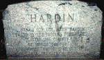
e seen today in the small park area in Hardin, six miles west of Sidney, at the intersection of State Route 47 and Hardin-Wapak Road. It is located on the southeast corner of the park. This monument commemorates not only the killing of Colonel Hardin by the Indians, but also marks the spot where the Shawnee camped in October, 1832, on their last trek from Ohio.


'Indian' segment written in December, 1997 by David Lodge

Piqua Shawnee
Piqua Shawnee Tribe

Friday, September 7, 2018

The War of 1812 in Alabama and the Creek War, 1813-1814


Causes:
The Federal Road divided the traditional Upper Creeks from more assimilated Lower Creeks.
  • Creek ownership of traditional lands was endangered as land-hungry whites moved across it or settled illegally on it.
  • The British sent Tecumseh, a Shawnee chief, from the Great Lakes to unite all Indians against white Americans and form an alliance with England and Spain.
  • England and Spain incited the Creeks against American settlers and supplied Creeks with guns and ammunition.
Battles raged on the frontier between Creek "Red Sticks" and American militia led by General Andrew Jackson. The last and most famous battle, the Battle of Horseshoe Bend (now a National Military Park) destroyed the strength of the Creek Nation. General Jackson forced the Creeks to sign the Treaty of Fort Jackson, ceding some forty thousand square miles of land to the United States.
Consequences:
  • Foreign influence among Indians was destroyed.
  • United States took Mobile from Spain, the only additional land acquired in War of 1812.
  • The Fort Jackson Treaty, acquiring Creek lands, began a series of forced land-cession treaties by the United States with other southern tribes until all were removed west.
  • General Andrew Jackson became a national hero for defeating the Creeks, a victory that helped pave his way to become President of the United States.

BIBLIOGRAPHY
Halbert, Henry S. and Timothy H. Ball. The Creek War of 1813-1814. 1895. Reprints, edited, with introductions and notes, by Frank L. Owsley Jr., Tuscaloosa: University of Alabama, 1969 and 1995.
In vivid detail, Halbert and Ball recount everything they could find about this conflict. The names of participants (their ancestors and children), locations of battles with full descriptions of gory scenes, and comments on accounts of informants and other writers make this a wonderful source. Students will find textbook accounts of the Fort Mims massacre pale compared to this one. The question of what caused the Creek conflict, whether it was a civil war brought on by factionalism between Lower Creeks and Upper Creeks, is debated.

Holland, James W. Andrew Jackson and the Creek: Victory at the Horseshoe. Tuscaloosa: University of Alabama Press, 1968. Reprint, 1990.
This fifty-page booklet, published to promote Horseshoe Bend National Military Park, offers a concise story of the events that brought an end to the Creek Nation in the South. Students will enjoy this well-illustrated, lively account.

Martin, Joel W. Sacred Revolt: The Muskogees' Struggle for a New World. Boston: Beacon Press, 1991.Martin approaches the history of the Muskogees (Creeks) from a religious point-of-view. According to his theory, their "culture of the sacred" determined how they interacted with and reacted to Europeans and, later, Americans. To support his theory, he discusses their spiritual, economic, and social background. He compares their revolt against the Americans in the Creek War with struggles of other native Americans to retain their traditions. It is an interesting theory that can provide an introduction to the religious beliefs of the Creeks.

Wright, J. Leitch Jr. Creeks and Seminoles: The Destruction and Regeneration of the Muscogulge People. Lincoln: University of Nebraska Press, 1986.

The names Creek and Seminole were attached to the Muscogulge people for the convenience of European and U.S. governments who wanted to address nations. The Muscogulge lived in Georgia, Alabama, and Florida—geographically close, but not unified under one leader. Although some had ancient common origins, many spoke different languages and often could not understand each other. Wright explains the background of the Muscogulges and describes their culture in language readily understood. He defines words that he believes might be unfamiliar to the general reader. He elaborates on familiar topics such as trade, relations with European powers and the U.S. government, the Creek Wars with Andrew Jackson and his pursuit of the survivors into Florida, and finally removal, dispersal, and survival. This book is an enlightening inside view of the Muscogulges' heroic struggle for survival; it is also an indictment of the U.S. Government.

Piqua Shawnee
Piqua Shawnee Tribe

http://www.archives.alabama.gov/results.html?q=shawnee

Thursday, September 6, 2018

Native Heritage Commission: Piqua Shawnee Exhibit - October 6, 2018 Opening Reception

Piqua Shawnee Exhibition_Book Oct 2018

Exhibition Dates October 6 - 31, 2018

Opening Reception October 6, 2018 3p-3p

Berea College - Hutchins Library

There will be about 30 – 35 framed images with accompanying text. Images are either 20 @20X30” and 12-15 @ 24X36” The topic is the Piqua Shawnee, many of whom live here in KY though the tribe is recognized in Alabama.
Piqua Shawnee
Piqua Shawnee Tribe

Wednesday, September 5, 2018

Fort Mims: Tensaw Alabama

Alabama Historical Commission
NATIONAL REGISTER OF HISTORIC PLACES
ahc-ftmims
The Fort Mims site commemorates the battle that led to the Creek War of 1813-14.
On August 30, 1813 over 700 Creek Indians destroyed Fort Mims. American settlers, U.S. allied Creeks, and enslaved African Americans had sought refuge in the stockade. The Creek warriors who carried out the attack were members of the Red Stick faction named for the red wooden war clubs they carried. Their assault on Fort Mims is considered one of the greatest successes of Indian warfare.
The Alabama Historical Commission owns this historic site. The Fort Mims Restoration Association is the support group in charge of operating the site.
Visit
https://ahc.alabama.gov/properties/ftmims/ftmims.aspx

Piqua Shawnee
Piqua Shawnee Tribe

ahc-header-logo2

Tuesday, September 4, 2018

Cornstalk's Death

Many Shawnee hoped to remain neutral during the American Revolution, but violence perpetrated by American settlers pushed the Shawnee to the British side. One of the loudest advocates for peace and neutrality was the Maquachake chief, Cornstalk, who corresponded regularly with Congressional Indian agent George Morgan. Cornstalk and other Maquachake leaders were so committed to neutrality that they announced plans to separate their peace faction and found a new town. In October 1777, Cornstalk led a peace delegation to Fort Randolph on the Kanawha River. There he was captured and detained by the fort commander, Captain Matthew Arbuckle. Captain Arbuckle then imprisoned Cornstalk's son, Elinipsico, who had come to Fort Randolph to inquire about his father's condition. The Shawnees remained imprisoned through early November 1777, when a party of local militia, seeking retaliation for the death of a white settler, broke into the fort and killed all of the Shawnee under guard, including Cornstalk.

While Cornstalk's death was officially denounced by Congress, Pennsylvania, and Virginia, Shawnee outrage at the chief's killing fueled a wave of retaliation and pushed most Shawnee away from the American side, at least during the Revolutionary war. One noted battle that occurred in the wake of Cornstalk's death was a raid by a Chillicothe war chief, Black Fish, in which he captured Kentucky settler Daniel Boone. Interestingly, Cornstalk's Maquachakes continued to pursue a policy of peace and neutrality with the Americans and the British. Most of the other Shawnee towns relocated closer to Sandusky and Detroit after the winter of 1777–1778. Beyond a faction of the Maquachakes, led by Chief Moluntha, most Shawnee sided with the British.

After the Peace of Paris, most Shawnee kept the United States at arm's length. The Shawnee did not join in the Treaty of Fort McIntosh (1785) and resoundingly rejected the "conquest theory" formulation of sovereignty that the Confederation Congress put forward in 1784 and after. While some Shawnee leaders (mostly Maquachake, Cornstalk's heir as the advocate for peace and coexistence) signed the subsequent Treaty of Fort Finney (1786), the majority still did want a treaty with the Americans. Their forbearance was understandable. As later in 1786, Kentucky militiamen attacked the Maquachake towns and killed chief Moluntha. During the 1790s, the Shawnee formed a large part of the pan-Indian resistance to the federal government led by the Miami chief, Little Turtle. In 1795, the Shawnee signed the Treaty of Greenville, terminating the resistance. However, a minority of the Shawnee, driven primarily by the Kispoki leader, Tecumseh, and his brother Tenskwatawa, would continue the resistance against the Americans until Tecumseh's death in Ontario at the battle of the Thames River (1813) during the War of 1812. After the War of 1812, the Shawnee were removed west of the Mississippi by the United States government, with most ending up in Oklahoma.

"Shawnee." Encyclopedia of the American Revolution: Library of Military History. . Encyclopedia.com. 3 Sep. 2018 http://www.encyclopedia.com.

www.piquashawnee.com
Piqua Shawnee
Piqua Shawnee Tribe